
| Newsletter | 11-03-2014 |
|
|
|
|
| Newsletter #11 |
|
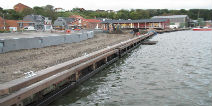
The 98 Danish municipalities are right now finalizing their action plans for climate change adaptation. More than half of the plans have been through a public consultation and the rest will catch up during the spring 2014. Each plan includes a flood risk mapping and sets the priorities for the local climate change adaptation measures.
Climate adaptation technologies
Implementation of the EU Floods Directive See the new maps here (only in Danish)
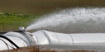
Agriwizard A new tool, Agriwizard is an interactive guide for farmers on protecting a farm against extreme weather events. Try the tool here.
More examples of climate change adaptation: |

|
|
|
|
|
|
||||
|
|
||||

|
|
|
|
|
|

|

|
|
|
|
|
Haraldsgade 53 2100 Copenhagen East
Phone: +45 72543000
E-mail: klimatilpasning@nst.dk
Phone: +45 72 54 30 00