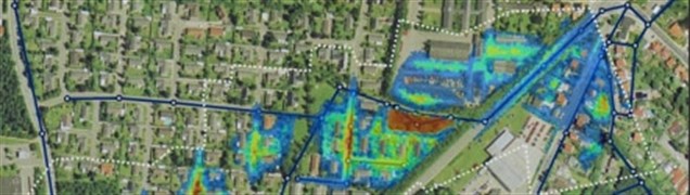
Flood map
A flood map is calculated on the basis of a Digital Terrain Model. The map shows depressions and hollows in the terrain that are potential flood areas. The calculations assume no possibilities for the water to escape via infiltration into the soil or through runoff into drains and stormwater drainage systems. The maps therefore only identify the areas at risk of water collecting and causing flooding.
Senest redigeret:
04-02-2014