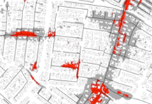
Hydraulic stormwater circulation
The flood map method can only be used to calculate the depth of
depressions and hollows, the size of their catchment areas, as well
as the flow routes. Using e.g. photo analysis and/or GIS analysis
of basic data, the calculations can factor-in paved areas. This
makes it possible to perform hydraulic stormwater calculations for
observed precipitation events. The calculations can be performed as
1D or 2D stormwater calculations, i.e. calculating the upstream
runoff either as one-dimensional channels or as two-dimensional
surfaces.

Senest redigeret:
05-02-2014